
 English
 Español
 Deutsch
 日本語
日本語 Polska
 Français
 中國
中國 한국의
한국의 Українська
 Italiano
 Nederlands
 Türkçe
 Português
 Bahasa Indonesia
 Русский
 हिंदी
हिंदीArizona Map Topographic STL Model Model do druku 3D


- Dostępne formaty: Stereolithography: stl 356.25 MB
- Kolekcja:No
- Width in millimeters:257
- Height in millimeters:4.7
- Depth in millimeters:304
- Gotowy do wydruku:No
- 3D Scan:No
- Adult content:No
- PBR:No
- AI Szkolenie:No
- Liczba wyświetleń:1943
- Data: 2022-06-14
- ID produktu:401995
- Oceny:
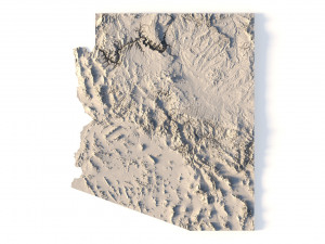
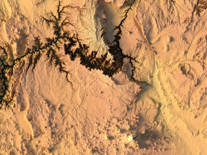
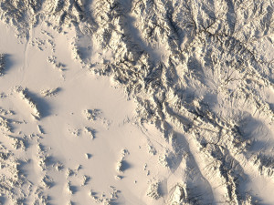
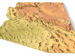
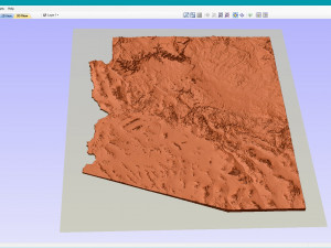
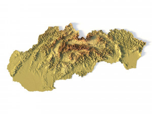
Create Detailed Arizona Topographic Maps with This 3D Model
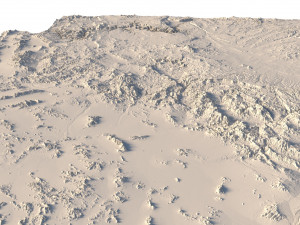
The Arizona Map Topographic STL model is designed to provide precise topography of Arizona’s terrain. Ideal for creating 3D topographic maps from wood, metal, plastic, or concrete, this model ensures detailed accuracy. Whether you’re into landscape visualization or need a reliable model for geospatial analysis and physical geography projects, this STL file is perfect for you.
• Format: STL
• Files size: 659 MB/ 329 MB
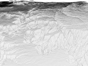
• Polygons: 13 841 070
• Vertices: 6 927 004
• Geometry: Polygonal Tris only
• Model size: 256.8 mm x 303.9 mm x 4.711 mm
• Distance between two neighboring vertices: ~ 0,1 mm
• Projection: Mercator
• Scaling factor X:Y:Z: 1:1:3
• Base: Open / Closed
Arizona Terrain Model: Features and Uses
• Compatible with FDM/SLA 3D printers for creating raised relief maps.
• Supports CNC machining for wood and metal terrain models.
• High-precision laser engraving for metal surfaces.
Jeśli potrzebny Ci plik w innym formacie, zgłoś taką potrzebę przez opcję Support Ticket Konwertujemy produkty na następujące formaty: .stl, .c4d, .obj, .fbx, .ma/.mb, .3ds, .3dm, .dxf/.dwg, .max. .blend, .skp, .glb. Nie konwertujemy scen 3D oraz formaty takie jak .step, .iges, .stp, .sldprt.!


